


PROGIRA® plan
PROFESSIONAL SPECTRUM PLANNING MADE SIMPLE.
PROGIRA® plan is a spectrum planning software essential for the successful design, implementation, optimization and evaluation of radio-frequency networks. It features a comprehensive range of powerful and fast applications that support planning for analogue and digital networks, as well as your network transition from analogue to digital.
SUPPORTS ALL SYSTEM STANDARDS
Besides, PROGIRA plan supports spectrum planning of all analogue and digital broadcast system standards that our users need. We follow the development of system standards closely. Once a new standard is introduced, we implement them within PROGIRA plan as soon as we can. For instance, we have recently launched FeMBMS module which enable the users to plan FeMBMS or 5G broadcast networks. Users can plan particular system standards, conduct simulation for various system standards that PROGIRA plan supports, and implement transitions between different standards (such as from DVB’s DVB-T1 to DVB-T2 or ATSC’s ATSC 1.0 to ATSC 3.0).
Supported system standards:
- DVB-T1 and DVB-T2
- ATSC 1.0 and ATSC 3.0
- ISDB-T
- T-DAB and DAB+
- DRM and DRM+
- CMMB
- DTMB-A
- T-DMB
- Analogue TV
- FM
- AM
- LTE
- FeMBMS/5G Broadcast
Couldn’t find what you need in the list? Contact us.
SYSTEM DESIGN
OPEN + MODULAR
An open and modular design which enables careful customizations, therefore our users enjoy a greater flexibility during their spectrum engineering process. PROGIRA plan software comprises of 5 functional modules: Base, Network Planning, Frequency Planning, Network Verification and Microwave Link Planning. You have the freedom to select the modules necessary to tailor to your ever-evolving requirements. In addition, you can select the type of system standards that you need for various planning projects around the world.
GIS
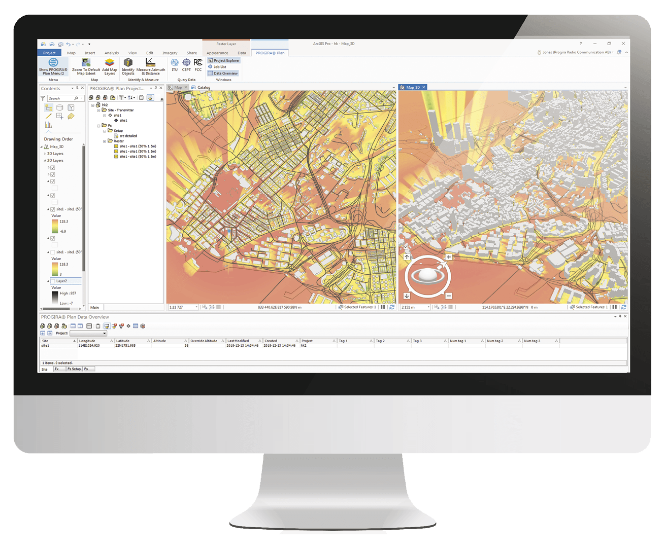
EMPOWERED BY WORLD’S LEADING GIS PLATFORM
Extend your spectrum engineering capabilities with the powerful combination of PROGIRA plan and Esri’s ArcGIS – the world’s leading mapping and analytics software. The planning software manages all data with ArcGIS. ArcGIS also has the flexibility to function as a standalone, open platform to serve your other spatial analytical needs. With ArcGIS, be confident that you will be equipped with a unique and superior set of capabilities to enhance your location-based analytics and gain valuable insights to your radio-frequency networks. Get ready to make a difference to your radio-spectrum planning with feature-packed ArcGIS.
Why Is ArcGIS Great?
What PROGIRA plan does?
Begin your spectrum planning workflow with the Basic Module of PROGIRA plan.
The Base Module provides a user-friendly interface with the following 4 essential steps in network planning:
Manages Data
Offers a stable and efficient platform where transmitter data from ITU, FCC, CEPT, Microsoft Excel or custom data formats can be imported,exported and filtered with ease. It also features a quick BR IFIC interface. Moreover, import and export data from any antenna manufacture formats. Create with 2D and 3D Antenna Pattern Editor.
Predicts Field Strengths
Calculates field strength predictions with various radio propagation models, such as CRC Predict, IRT 2D/3D, ITU-R P.1812, ITU-R P.1546, ITU-R P.526, ITU-R P.368, Deygout-Assis, Longley-Rice, Anatel 1546, Okumara-HATACOST-231, ITU-R P.526, Free Space, to name a few. We also integrate propagation models not in our list upon request.
Sums Predictions
Performs System Independent Summations from the field strength predictions calculations to provide valuable information on your networks: the Best Server, Second Best Server, and Third Best Server in your networks. We also let you know the number of servers in your network.
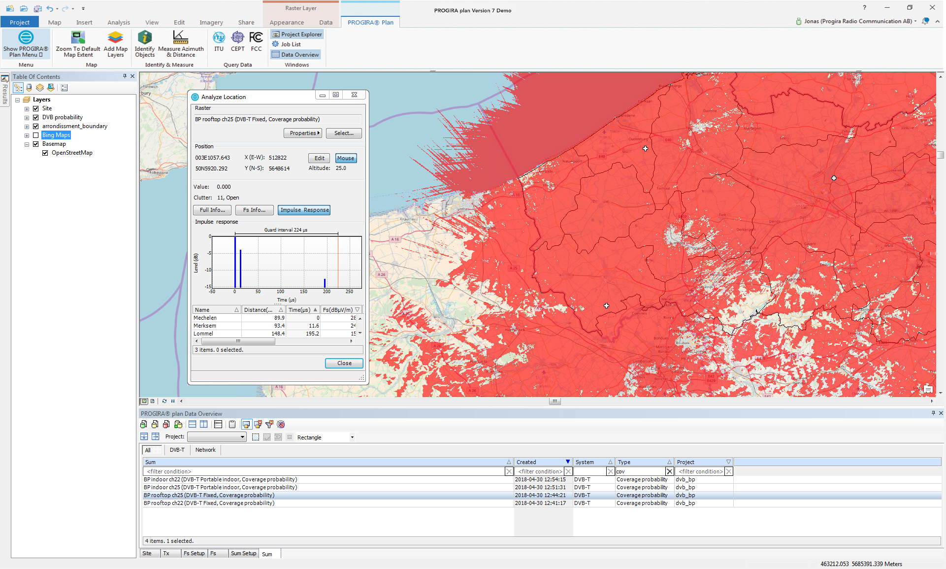
Analyze
Perform Interference Search, Population Coverage Analysis, Area Coverage Analysis, and Location Analysis. Discover the Path Profile Viewer and Coverage Map Comparisons to bring your radio-frequency network planning to the next level.
Optimize your network with a selection of advanced, functional specific modules
While the Base Module features dedicated tools to help you begin your spectrum planning, the Advanced Modules enable you to make strategic decisions to help you build and optimize networks cost-efficiently. There are 4 advanced modules available as an add-on to PROGIRA plan: Network Planning Module, Frequency Planning Module, Network Verification Module and Microwave Link Planning Module. You can select the necessary module based on your network planning requirements. Contact us to know which modules you need in PROGIRA plan and start planning your networks.
NETWORK PLANNING MODULE
Exclusive functions that supports optimization of the Single Frequency Networks (SFN) and the Multiple Frequency Networks. Features SFN OPTIMIZATION which enhances SFN coverage , by activating with a single click. This function uses an advanced algorithm which automatically assigns transmitters’ delays so that self-interference is reduced.
Network Planning Module
FREQUENCY PLANNING MODULE
Coordinates and optimize the use of frequencies with maximum efficiency while complying with international regulations and bilateral agreements.
- allotment/SFN editor
- BR IFIC Interface
- Coordination calculation
- Frequency Scan
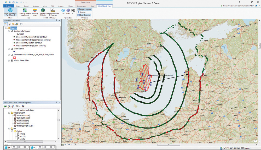
Frequency Planning Module
NETWORK VERIFICATION MODULE
Through network verification, improve the accuracy of your network measurements. It presents, analyzes, and compares field measurement data, which can be imported from all measurement systems. Through the results, you can fine-tune propagation models, thus enhancing the accuracy of your planning.
Mapped Points from Network Verification Module
Ready for a PROGIRA plan Demo?
WHY IS SPECTRUM PLANNING IMPORTANT?
Do you believe that your radio-frequency networks are achieving your coverage requirements?
Do you believe that your radio-frequency networks are free of interference?
Do you also believe that your customers are receiving high-quality signals and enjoying your services?
With radio-frequency network planning, you can transform all beliefs, to a scientific certainty. Radio-frequency networks need to be regularly planned so that they can be optimized to a dynamically, changing environment. Your network performance and coverage are affected by the rapidly evolving urban landscape, demography, and the state of infrastructure. Furthermore, radio-frequency network management is impacted by spectrum availability, tighter frequency reuse, and the increasing number of service providers. Unless your network is deployed in a static environment, radio-frequency network planning is essential to help you overcome challenges of maintaining a reliable, efficient, and cost-effective network. PROGIRA plan uses advanced algorithms, radio propagation models, and powerful GIS platforms to help you conduct accurate analysis and optimization of your spectrum.
Contact us about a better way to plan your spectrum.
Complete the form on the left so we can get in touch with you.
Wish to contact us directly? Call +46 920 750 50 or drop an email at [email protected].