
PROGIRA plan Version 8.3.0 release notes
16th Oct 2025
The PROGIRA software development team is proud to announce the release of PROGIRA plan Version 8.3.0
PROGIRA® plan version 8.3.0 is a upgrade with improvements and bug fixes. It also contains a lot of updates back from version 8.1.0.
The software is fully functional in esri ArcGIS Pro (3.5.x). PROGIRA® plan version 8.3.0 is also compatible with ArcGIS Desktop 10.8.2.
Highlights:
Our top features implemented in the release include
- Further developed of ATSC 3.0 module
- New propagation model
- Microwave link Module update
- Settings section update
What’s New?
1. ATSC 3.0 module
In this version, the ATSC 3.0 module has been further developed, with the main purpose being to provide planning support for the Brazilian TV3.0 system.
MIMO (Multiple Input Multiple Output) has been added to the ATSC 3.0 summation. The MIMO update is based on an algorithm provided by ETRI (Electronic Telecommunications Research Institute) in South Korea. See also https://www.progira.com/updates-in-progira-plan-for-mimo-using-atsc-3-0-to-support-to-brazilian-tv3-planning/
2. ITU-R P.452-18 propagation model
ITU-R P.452-18 propagation model has been added.
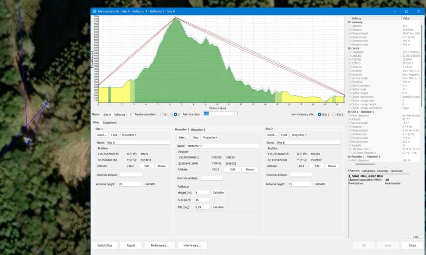
3. Microwave link module
Support for passive reflectors has been added into Microwave link module.
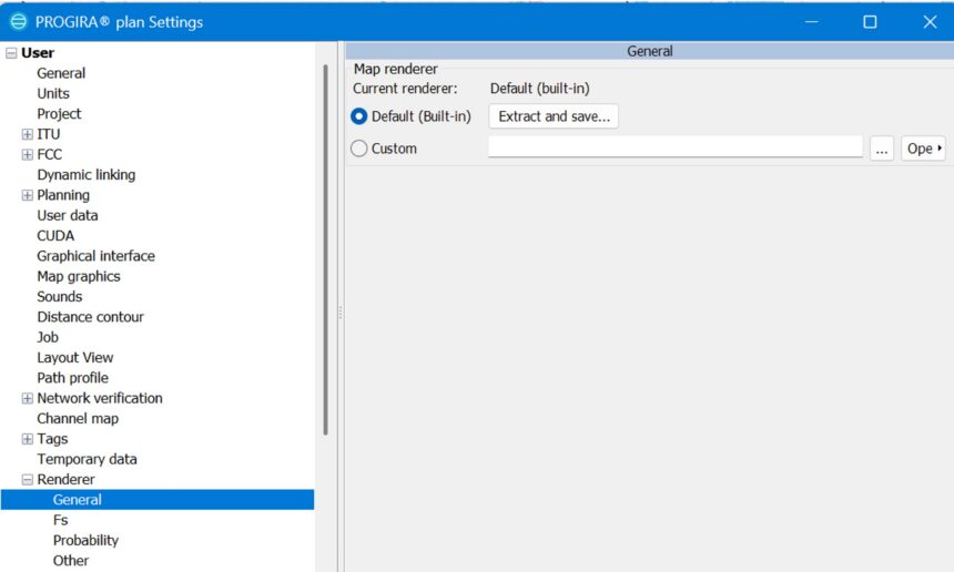
4. Settings section update
Change Map renderers by editing the file where they are defined.
Request for a complete release notes?
Need a Version Upgrade?
Contact us or simply submit a request form.